
File:Honduras location map.svg

Size of this PNG preview of this SVG file: 800 × 497 pixels. Ither resolutions: 320 × 199 pixels | 640 × 397 pixels | 1,024 × 636 pixels | 1,280 × 795 pixels | 2,560 × 1,589 pixels | 923 × 573 pixels.
Oreeginal file (SVG file, nominallie 923 × 573 pixels, file size: 485 KB)
Ootline
| Descreeption |
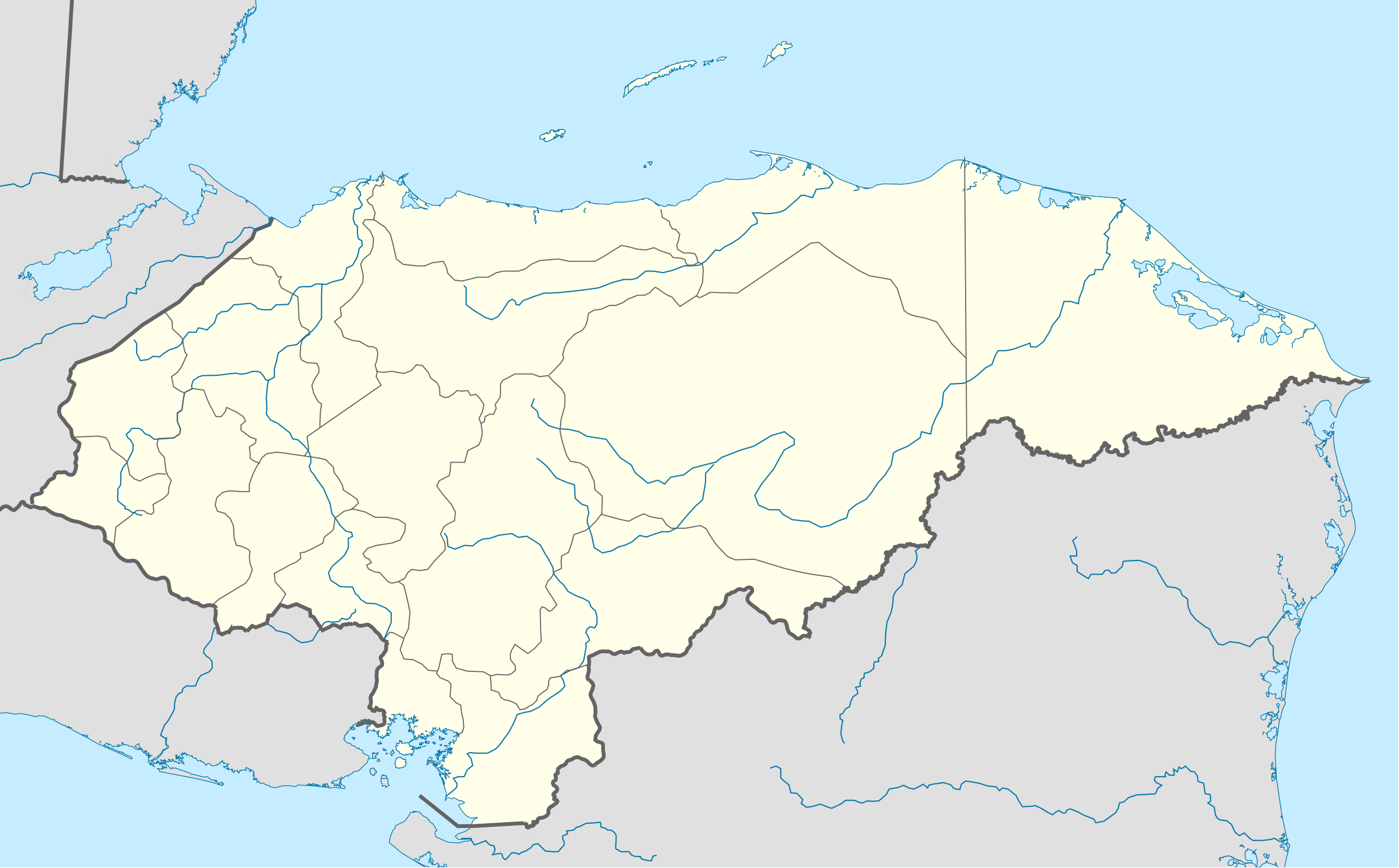
English: Location map of Honduras. Geographic limits of the map: * West : 269.50 W * East : 89.00W * North : 24.00N * South : 180.00N |
| Date | |
| Soorce | OpenStreetMap.org (CreativeCommons license) |
| Author | Addicted04 |
| Other versions | Derivative works of this file: Copan en Honduras.png |
| SVG genesis |
Licensin
I, the copyright holder of this work, hereby publish it under the following licenses:
This file is licensed unner the Creative Commons Attribution-Share Alike 3.0 Unported license.
- Ye are free:
- tae share – tae copy, distribute an transmit the wirk
- tae remix – tae adapt the wirk
- Unner the follaein condeetions:
- attribution – Ye must attribute the wirk in the manner specified bi the author or licensor (but nae in ony way that suggests that thay endorse ye or yer uise o the wirk).
- share alik – If ye alter, transform, or big upon this wirk, ye mey distribute the resultin wirk anly unner the same or seemilar license tae this ane.

|
Permission is grantit tae copy, distribute an/or modify this document unner the terms o the GNU Free Documentation License, Version 1.2 or ony later version published bi the Free Software Foundation; wi no Invariant Sections, no Front-Cover Texts, an no Back-Cover Texts. A copy o the license is includit in the section enteetled GNU Free Documentation License. |
Ye mey select the license o yer choice.
File history
Clap oan ae date/time fer tae see the file aes it kithed at that time.
| Date/Time | Thummnail | Dimensions | Uiser | Comment | |
|---|---|---|---|---|---|
| current | 20:14, 15 October 2009 | | 923 × 573 (485 KB) | Addicted04 | {{Information |Description={{en|1=Location map of Honduras.<br/>Geographic limits of the map:<br/>* West : 89° 50' W<br/>* East : 83° 00' W<br/>* North : 16° 70' N<br/>* South : 12° 80' N}} |Source=OpenStreetMap.org (CreativeCommons license) |Author=[ |
Eimage airtins
The follaein pages airts tae this image:
Global file uisage
The follaein ither wikis uise this file:
- Uisage on af.wikipedia.org
- Uisage on an.wikipedia.org
- Uisage on ar.wikipedia.org
- Uisage on ast.wikipedia.org
- Uisage on az.wikipedia.org
- Uisage on ba.wikipedia.org
- Uisage on be-tarask.wikipedia.org
- Uisage on be.wikipedia.org
- Uisage on bg.wikipedia.org
- Uisage on bn.wikipedia.org
- Uisage on bs.wikipedia.org
- Uisage on ca.wikipedia.org
- Uisage on ceb.wikipedia.org
View mair global usage o this file.